Severe Weather Risks for Kansas City (latitude 39.1239, longitude -94.5541)
This feature is experimental and for now, shows times in UTC instead of local time.
most recent update: Saturday @ 20:02 Z
Day 1-3 outlooks
Day 4-8 outlooks
If unknown/low, check back later for updates.
More information about tornado/wind/hail risks on severe weather outlook.com
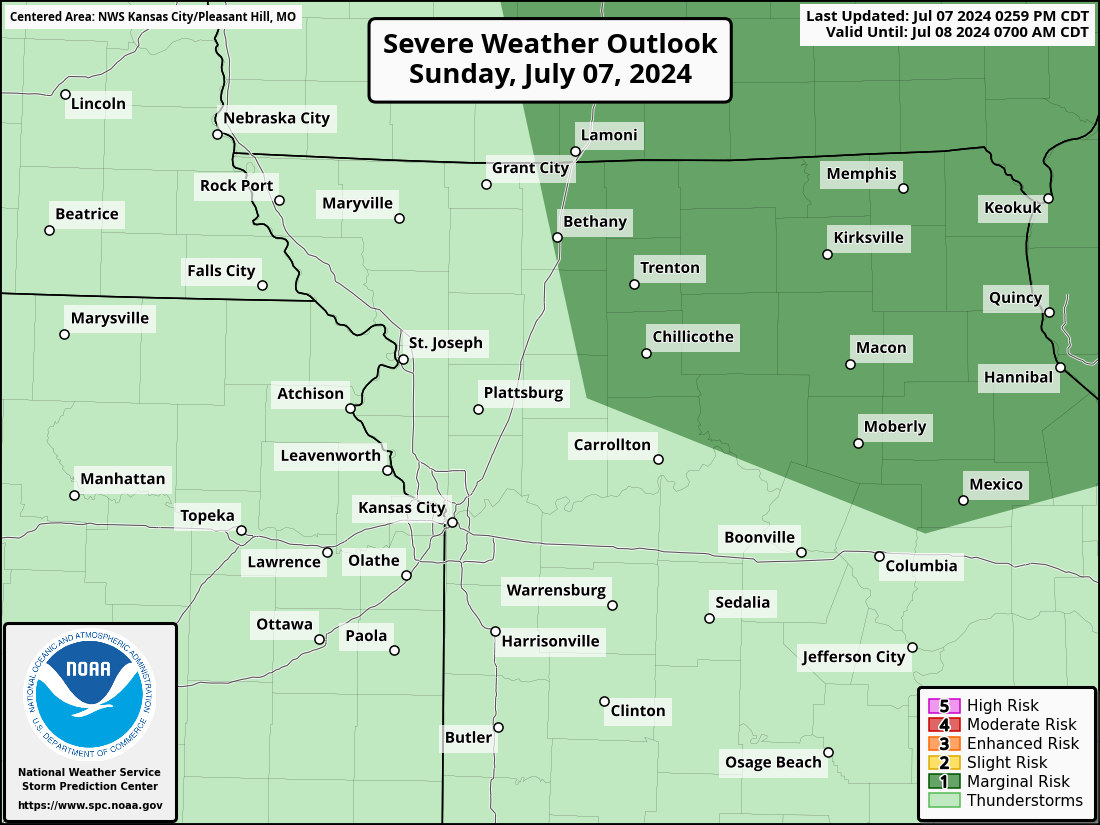
Kansas City, MO Severe Weather Outlook
Kansas City, MO is located in Jackson county Missouri, roughly centered around latitude 39.1239 and longitude -94.5541 (open location in openstreetmap).
Below is the state-wide Missouri severe weather outlook. If you're interested in other states or to see the outlook for the entire US, visit the main page.
Kansas City, MO Severe Weather Outlook Next 3 Days


Kansas City, Missouri's NWS office: Kansas City/Pleasant Hill, MO (EAX)
Kansas City, Missouri's National Weather Service forecast office is Kansas City/Pleasant Hill, MO . Its short name is EAX . You may see this code referenced in URLs and forecasts. For instance, the direct URL for your local NWS office is https://www.weather.gov/eax/
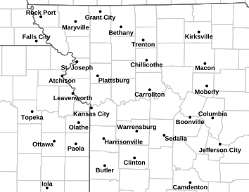
Kansas City, MO (EAX) County Warning Area
Different NWS offices are responsible for the forecasts and warnings for different counties/parishes/boroughs. This geographic region is called the County Warning Area (CWA). The CWA borders can sometimes seem quite arbitrary.
Here is today's severe weather outlook highlighting the counties that the Kansas City/Pleasant Hill, MO
NWS office is responsible for:
Current hazard map for Kansas City, MO and the surrounding area
Click the image to go to the Kansas City/Pleasant Hill, MO NWS site to find out more about
the current hazards.
For reference, see the US hazards map below. However, if there are any
hazardous weather outlooks in effect (this is their color)
, they will appear on the local map above, but not on the national
map below.

Location details for Kansas City, Missouri
- Latitude: 39.1239
- Longitude: -94.5541
- Zip codes: 64161 64163 64165 64167 64053 64151 64153 64155 64154 64157 64156 64158 64108 64109 64102 64106 64105 64101 64128 64129 64124 64125 64126 64127 64120 64123 64164 64166 64192 64119 64118 64114 64117 64116 64111 64110 64113 64112 64132 64130 64146 64145 64149 64147 64139 64138 64133 64131 64137 64136 64134 64121 64141 64148 64162 64170 64171 64179 64180 64184 64187 64188 64191 64195 64196 64197 64198 64199 64999
- Zip codes: 64161, 64163, 64165, 64167, 64053, 64151, 64153, 64155, 64154, 64157, 64156, 64158, 64108, 64109, 64102, 64106, 64105, 64101, 64128, 64129, 64124, 64125, 64126, 64127, 64120, 64123, 64164, 64166, 64192, 64119, 64118, 64114, 64117, 64116, 64111, 64110, 64113, 64112, 64132, 64130, 64146, 64145, 64149, 64147, 64139, 64138, 64133, 64131, 64137, 64136, 64134, 64121, 64141, 64148, 64162, 64170, 64171, 64179, 64180, 64184, 64187, 64188, 64191, 64195, 64196, 64197, 64198, 64199, 64999