Severe Weather Risks for Wichita Falls (latitude 33.9072, longitude -98.5291)
This feature is experimental and for now, shows times in UTC instead of local time.
most recent update: Thursday @ 20:02 Z
Day 1-3 outlooks
Day 4-8 outlooks
If unknown/low, check back later for updates.
More information about tornado/wind/hail risks on severe weather outlook.com
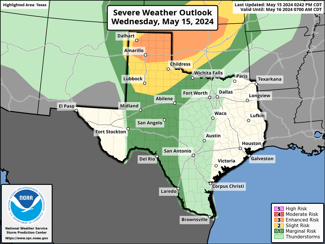
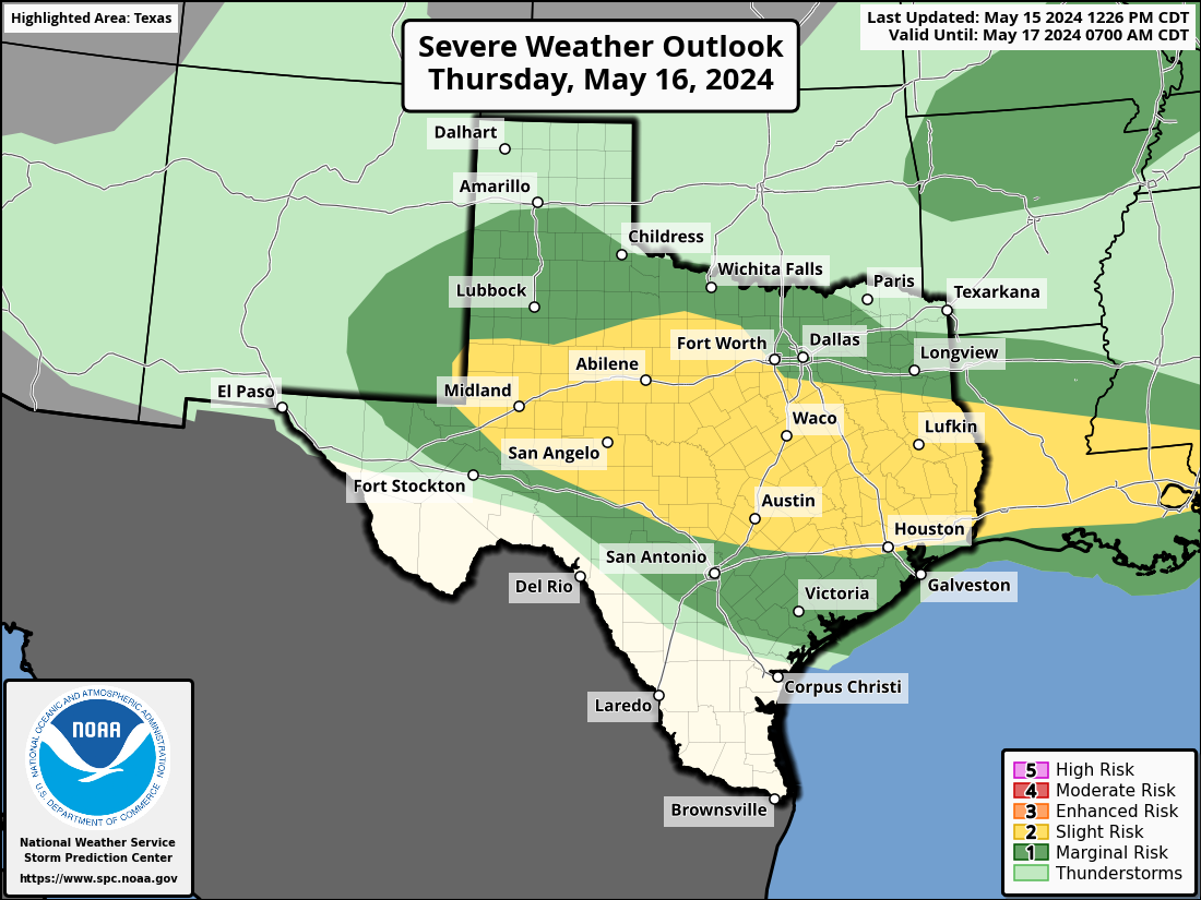
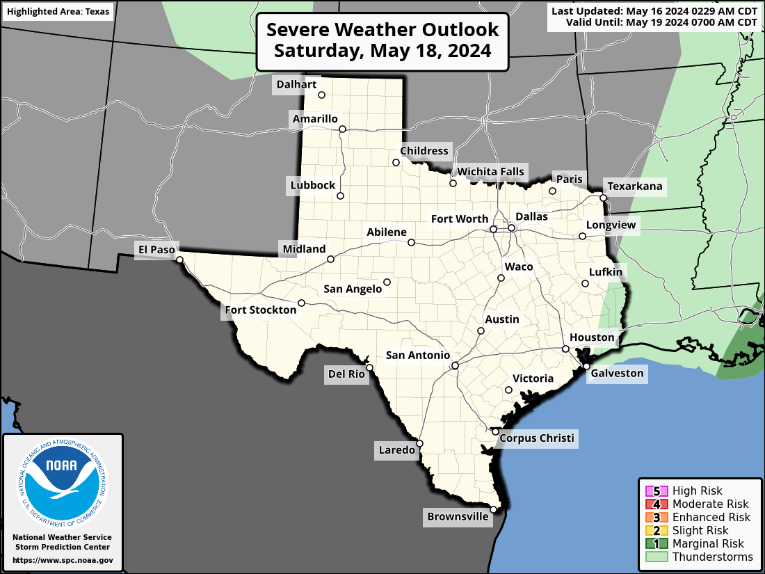
Wichita Falls, TX Severe Weather Outlook
Wichita Falls, TX is located in Wichita county Texas, roughly centered around latitude 33.9072 and longitude -98.5291 (open location in openstreetmap).
Below is the state-wide Texas severe weather outlook. If you're interested in other states or to see the outlook for the entire US, visit the main page.
Wichita Falls, TX Severe Weather Outlook Next 3 Days
Wichita Falls, Texas's NWS office: Norman, OK (OUN)
Wichita Falls, Texas's National Weather Service forecast office is Norman, OK . Its short name is OUN . You may see this code referenced in URLs and forecasts. For instance, the direct URL for your local NWS office is https://www.weather.gov/oun/
Wichita Falls, TX (OUN) County Warning Area
Different NWS offices are responsible for the forecasts and warnings for different counties/parishes/boroughs. This geographic region is called the County Warning Area (CWA). The CWA borders can sometimes seem quite arbitrary.
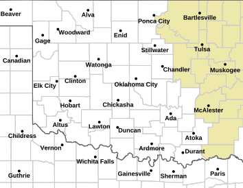
Here is today's severe weather outlook highlighting the counties that the Norman, OK
NWS office is responsible for:
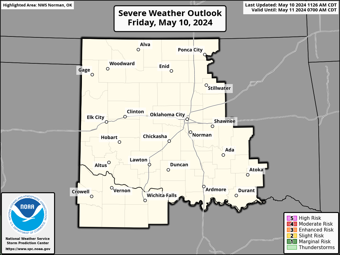
Current hazard map for Wichita Falls, TX and the surrounding area
Click the image to go to the Norman, OK NWS site to find out more about
the current hazards.
For reference, see the US hazards map below. However, if there are any
hazardous weather outlooks in effect (this is their color)
, they will appear on the local map above, but not on the national
map below.

Location details for Wichita Falls, Texas
- Latitude: 33.9072
- Longitude: -98.5291
- Zip codes: 76308 76310 76311 76309 76306 76305 76302 76301 76307
- Zip codes: 76308, 76310, 76311, 76309, 76306, 76305, 76302, 76301, 76307