Severe Weather Risks for Huntington (latitude 38.4109, longitude -82.4344)
This feature is experimental and for now, shows times in UTC instead of local time.
most recent update: Tuesday @ 20:07 Z
Day 1-3 outlooks
Day 4-8 outlooks
If unknown/low, check back later for updates.
More information about tornado/wind/hail risks on severe weather outlook.com
Huntington, WV Severe Weather Outlook
Huntington, WV is located in Cabell county West Virginia, roughly centered around latitude 38.4109 and longitude -82.4344 (open location in openstreetmap).
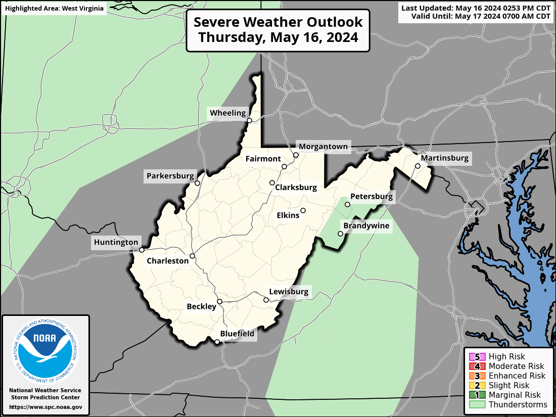
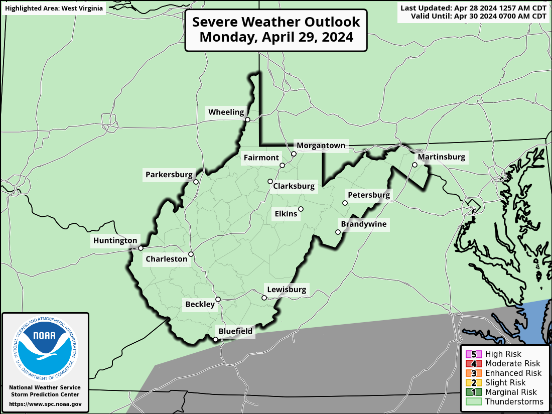
Below is the state-wide West Virginia severe weather outlook. If you're interested in other states or to see the outlook for the entire US, visit the main page.
Huntington, WV Severe Weather Outlook Next 3 Days

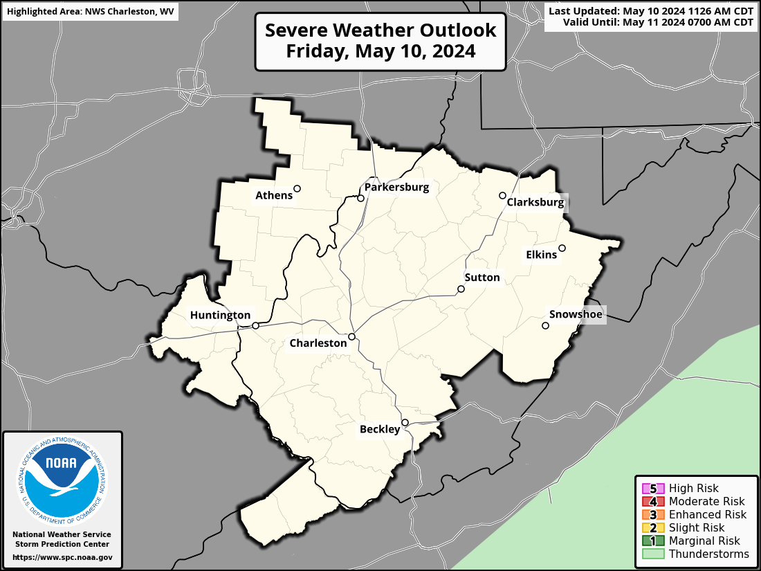
Huntington, West Virginia's NWS office: Charleston, WV (RLX)
Huntington, West Virginia's National Weather Service forecast office is Charleston, WV . Its short name is RLX . You may see this code referenced in URLs and forecasts. For instance, the direct URL for your local NWS office is https://www.weather.gov/rlx/
Huntington, WV (RLX) County Warning Area
Different NWS offices are responsible for the forecasts and warnings for different counties/parishes/boroughs. This geographic region is called the County Warning Area (CWA). The CWA borders can sometimes seem quite arbitrary.
Here is today's severe weather outlook highlighting the counties that the Charleston, WV
NWS office is responsible for:
Current hazard map for Huntington, WV and the surrounding area
Click the image to go to the Charleston, WV NWS site to find out more about
the current hazards.
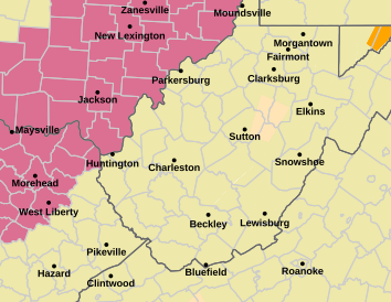
For reference, see the US hazards map below. However, if there are any
hazardous weather outlooks in effect (this is their color)
, they will appear on the local map above, but not on the national
map below.

Location details for Huntington, West Virginia
- Latitude: 38.4109
- Longitude: -82.4344
- Zip codes: 25703 25702 25701 25705 25704 25706 25708 25709 25710 25711 25712 25713 25714 25716 25717 25718 25719 25720 25721 25722 25723 25724 25725 25726 25727 25728 25729 25755 25772 25773 25774 25775 25776 25777 25778
- Zip codes: 25703, 25702, 25701, 25705, 25704, 25706, 25708, 25709, 25710, 25711, 25712, 25713, 25714, 25716, 25717, 25718, 25719, 25720, 25721, 25722, 25723, 25724, 25725, 25726, 25727, 25728, 25729, 25755, 25772, 25773, 25774, 25775, 25776, 25777, 25778